©
Schladming Dachstein
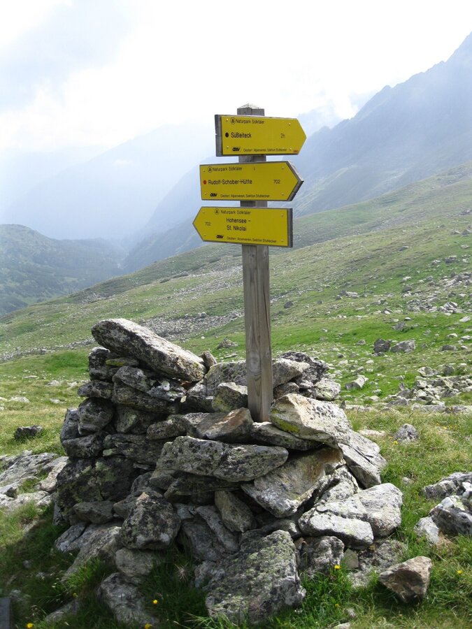
Hohensee - Schimpelscharte - Etrachsee
difficult Dog · Naturpark Sölktäler
Tour characteristics
Stamina
Technique
Tour-Infos
Distance: 14.4 km
Duration: 07:00 h
Ascent: 1141 m
Descent: 893 m
Best time of year
january
february
march
april
may
june
july
august
september
october
november
december
The tour
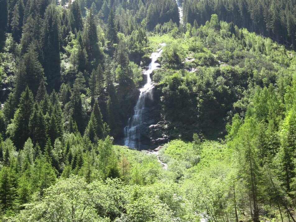
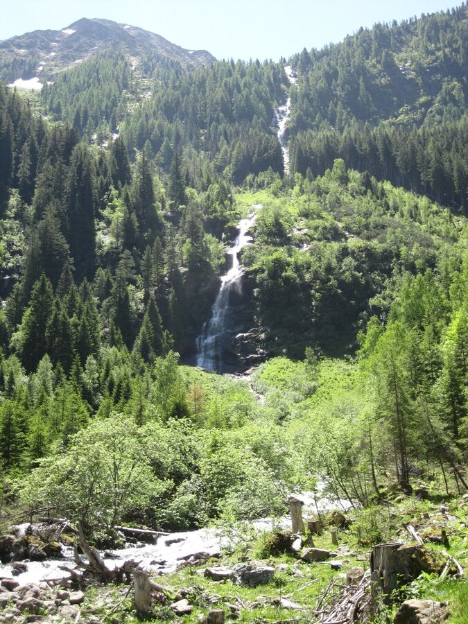
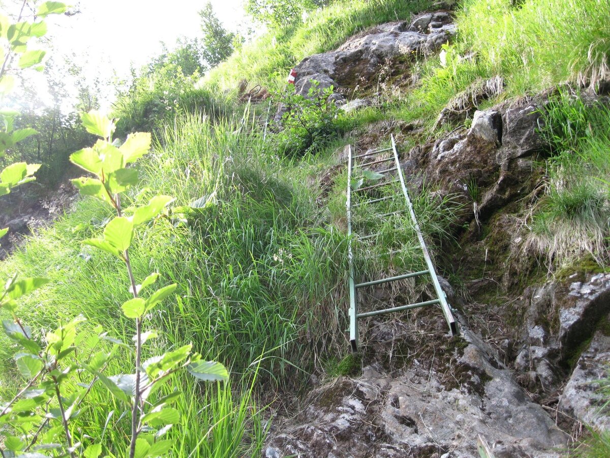
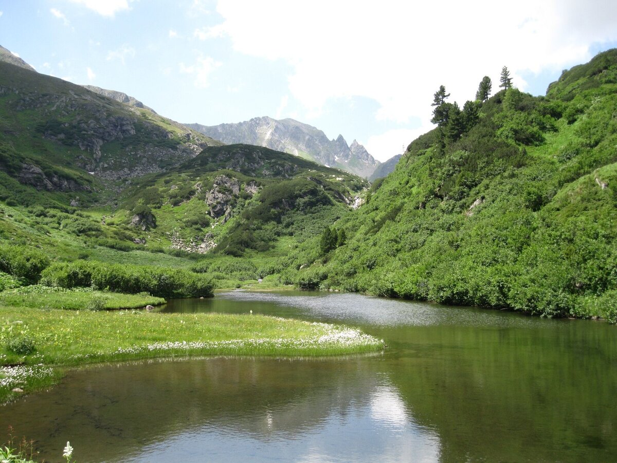
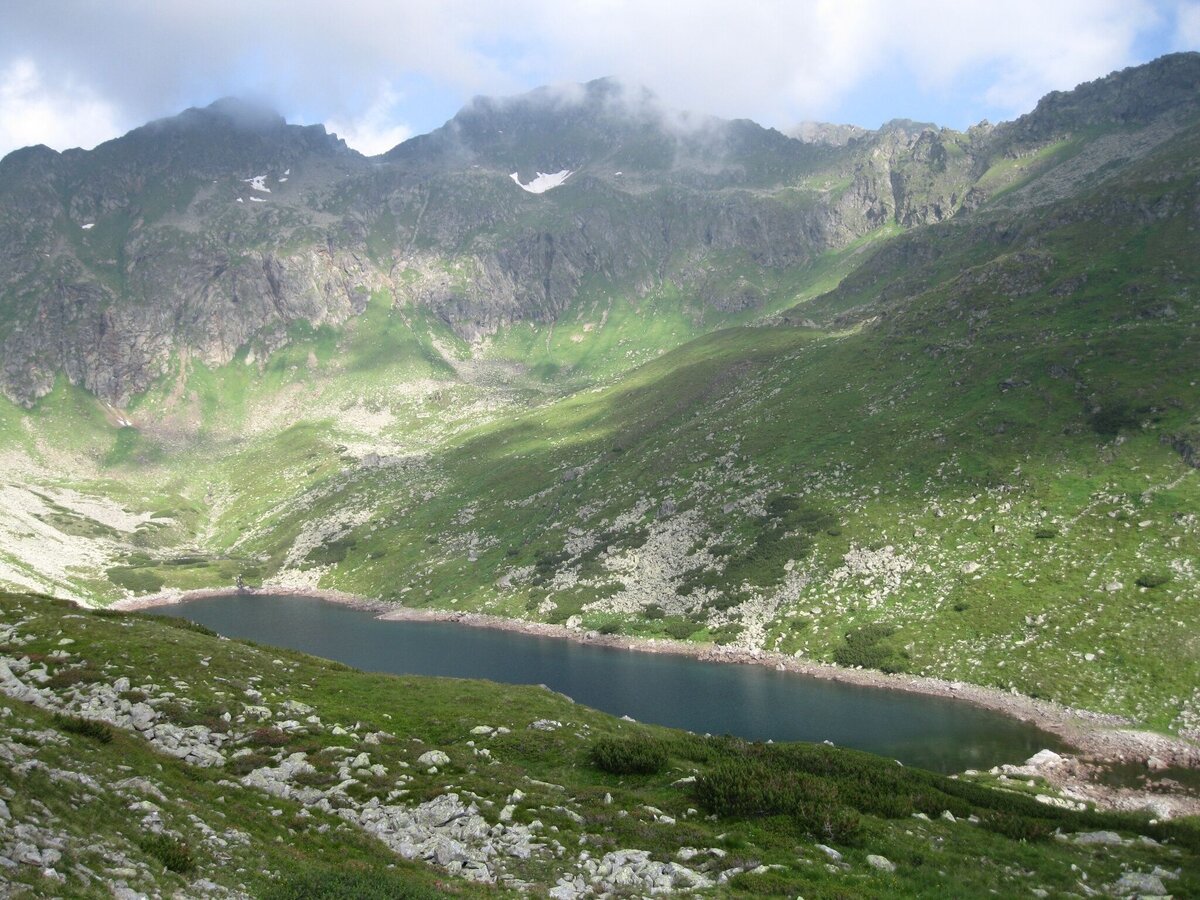
The road over Sölkpass into Murtal Valley begins in St. Nikolai. Central Alps Path 02 also begins in St. Nikolai. After the church, it first takes us on a flat walk alongside the Bräualmbach in the direction of the Hohensee. A beautiful path on which to warm up, since once we get to the valley head and the waterfall, we encounter our first steep climb through high forest up to the Hohensee. Aside from several dilapidated huts, there are two others built of marble rock that, though not staffed, are still standing. The lake itself is like a precious gem, in an alpine hollow surrounded by mountains, a beautiful spot to take a break. Our path now leads above the lake and down into the furthest corner of the valley head, then winding its way between alders and tall slabs of rock to a craggy section. We cross this with the help of a ladder, at which point the landscape changes; the forest is left behind, rounded hilltops, ground smooth by glaciers and covered in moss, now dominate the scenery. Our trail takes us to the stream, the valley becomes incredibly narrow and the stream actually becomes our path. We have to continually switch sides of the stream, clambering over slabs of rock and coming to a small dammed up section teeming with flowers.A gigantic high cirque opens before us, and the trail leads along a striking ridgeline to the left, the mountainside becoming ever steeper until we finally reach the Schimpelscharte.Deep below lies the green Schimpelsee, before us a low stone wall divides the rounded crest of the Schimpelscharte – at an elev. of 2,273m, this is the highest point of this alpine tour. Beautiful views to the north and south.
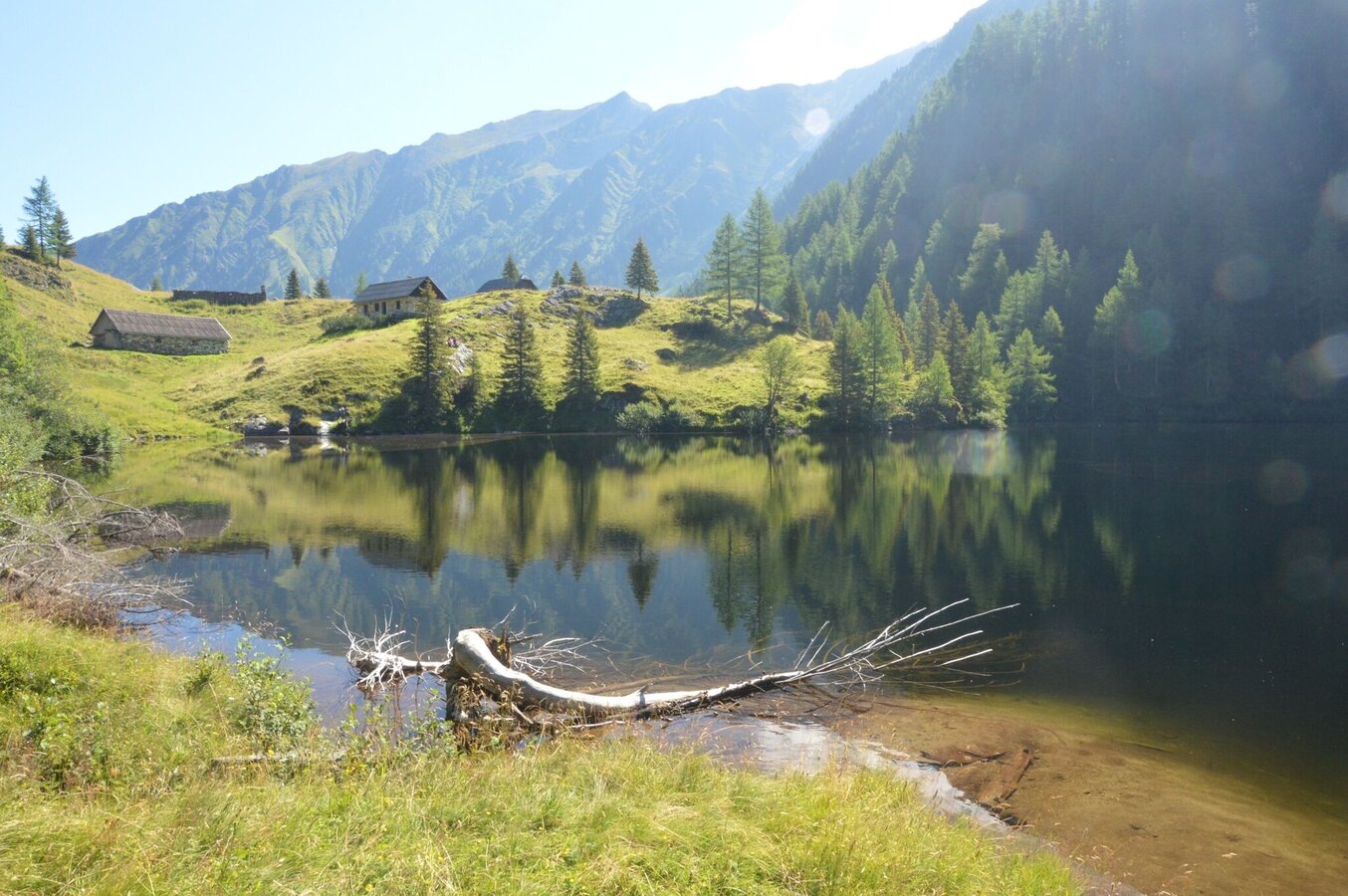
Our hike down is initially steep and we have to contend with a loose rock, hugging the cliffs as we make our way down to the broad cirque of the Grafenalm. Amid the following piles of rock, the first pine trees herald our return to the tree line, and soon we leave the bare terrain behind us. Mosses, rhododendron and blackberry bushes line our path, and we enter a beautiful pine forest. The Rudolf Schober Hütte is our first refreshment opportunity. The final descent to the Etrachsee isn’t far away, leading us through a beautiful area of alpine pastures to the romantic lake with its friendly mountain inn – their specialty: smoked trout. This is also the stop for the valley bus, which runs through the Krakau area via Ranten, and from there over Sölkpass to St. Nikolai.
Our hike down is initially steep and we have to contend with a loose rock, hugging the cliffs as we make our way down to the broad cirque of the Grafenalm. Amid the following piles of rock, the first pine trees herald our return to the tree line, and soon we leave the bare terrain behind us. Mosses, rhododendron and blackberry bushes line our path, and we enter a beautiful pine forest. The Rudolf Schober Hütte is our first refreshment opportunity. The final descent to the Etrachsee isn’t far away, leading us through a beautiful area of alpine pastures to the romantic lake with its friendly mountain inn – their specialty: smoked trout. This is also the stop for the valley bus, which runs through the Krakau area via Ranten, and from there over Sölkpass to St. Nikolai.
Gallery


More information
Getting there
Turn off the Ennstalstraße B320 at Pruggern (west) or Espang (east) in the direction of the Sölktäler Nature Park. In Stein/Enns turn off towards Sölkpass, and after about 18 km you will reach the parking lot on the outskirts of St. Nikolai.
Arrival at Stein/Enns train station with ÖBB.
Cab Stefan Mayer: +43 676 54 09 858
Valley bus from July 5 to September 7, 2025 - this makes crossings in the Sölktäler Nature Park possible. You can also travel comfortably by train and the valley bus will take you to the starting point of your hike. Click here for the timetable.
Parking
Parking area at the beginning of the village St. Nikolai.
Start
St. Nikolai in Großsölktal, P at the entrance to the village
Destination
Etrachsee
Equipment
Weather changes, rapid drop in temperature, thunderstorms, wind, fog and snow fields are objective dangers and require the right behavior on the way. Hut keepers are experienced mountain connoisseurs, they can give good tips on the weather and the course of the trail. Lack of equipment, overestimation of one's own abilities, carelessness, poor physical condition and a wrong assessment can lead to critical situations. During thunderstorms: avoid peaks, ridges and rope belays at all costs.
GPS data and orientation aids: Available GPS data - as well as hiking maps - are only an orientation aid, since they can never represent an exact image or the richness of detail of a path in reality. Especially in the case of danger spots, it must therefore always be decided in the end on the basis of the conditions on site whether and how the further course of the path looks like.
In case of emergency, please dial the following emergency numbers:
No. 140 - for alpine emergencies - Austria-wide
No. 112 - Euro emergency call GSM emergency call service
Take rainproof and warm clothes and enough water, possibly also a snack, wear shoes with non-slip profile soles. A first aid kit should also be in your backpack.
Author’s recommendation
SummitLynx- Your digital summit and hut book - available worldwide and always with you!
Tips, hints and links
Mountain guides from the region: www.schladming-dachstein.at/mountainguides
For more information, please contact the Schladming Dachstein Tourist Office - Sölktäler Nature Park Information Center:
Phone: +43 3687 23310 501
mailto:info@schladming-dachstein.at
Stein an der Enns 107
8961 Sölk
The brochure
“Hiking- center” is available in all information offices in the
region.
Weather forecast
Date
Dry and fair in the early morning, then variable with frequent showers.
Fair in the early morning, then scattered showers and finally widespread rain.
Unsettled with showers, but also sunny spells from the morning on.


