We frequently receive questions about the signage of hiking trails, running routes, and biking routes. On this page, we've summarized the most important information about signage for you. The examples shown below represent the uniform concept currently being implemented in the Schladming-Dachstein region. This concept was launched in 2024 and will be implemented on an ongoing basis, meaning it may take some time until all signs throughout the region comply with these standards. However, in terms of basic orientation, most other systems currently in use are similarly structured.

Danke, dass du nicht abseits der Wege wanderst, um…
…die Fauna und Flora zu schützen.
Die Alpen sind Heimat zahlreiche Tier- und Pflanzenarten, die für die Biodiversität wichtig sind. Abseits der Wege können wir unbewusst Lebensräume zerstören.
…die Wildtiere zu respektieren.
Abseits der Wege befindest du dich oft in empfindlichen Lebensräumen, die durch dein Vorbeigehen unnötig gestört werden, was Tiere stresst und vertreibt.
…sicher unterwegs zu sein.
Abseits der Wege ist das Gelände oft gefährlich, mit steilen Hängen und losen Felsen. Auf markierten Wegen ist das Risiko von Verletzungen oder Orientierungslosigkeit geringer.
…die Landschaft wertzuschätzen.
Abseits der Wege können Felder, Wiesen und Weiden beschädigt werden, was den Bauern unnötige Probleme bereitet.
…die Wanderwege zu erhalten.
Verlassen viele Wanderer die Wege, entstehen neue Pfade, die gepflegt werden müssen, was Ressourcen bindet und die Landschaft schädigt.
Beschilderungskonzepte
in der Region Schladming-Dachstein
Die nachfolgend aufgezeigten Beispiele sind das einheitliche Konzept, welches sich in der Region Schladming-Dachstein gerade in Umsetzung befindet. Der Startschuss hierfür erfolgte 2024 und wird laufend umgesetzt, d.h. es kann noch einige Zeit in Anspruch nehmen bis alle Schilder in der gesamten Region diesen Normen entsprechen. Von der grundlegenden Orientierung sind allerdings auch die meisten anderen, derzeit noch genutzten Systeme, ähnlich aufgebaut.
Hiking signage
Wanderbeschilderung
-
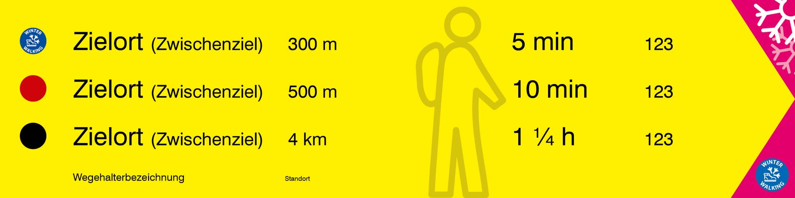
Sign size: 600 x 150 mm
-
Content: 1-3 lines with difficulty level, destination, walking time or distance, and the trail number.
-
Winter suitability: A magenta arrowhead indicates that the route is accessible from this point in winter. There is also an icon for winter hiking or snowshoeing.
-
Winter icons: If a hiking destination is also accessible in winter, the corresponding icon is displayed in the difficulty level section of the sign.
-
Distance information: In addition to the destination, a distance can optionally be specified, as distances are often more helpful than walking times in winter.
-
-
Reason for winter integration: This saves on signs and maintenance costs, as year-round accessible routes do not require seasonal installation or removal.
-
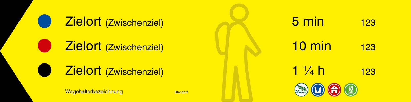
Footer: Contains the trail marker, location number, location name, and pictograms of circular trails if they run along the route.
-
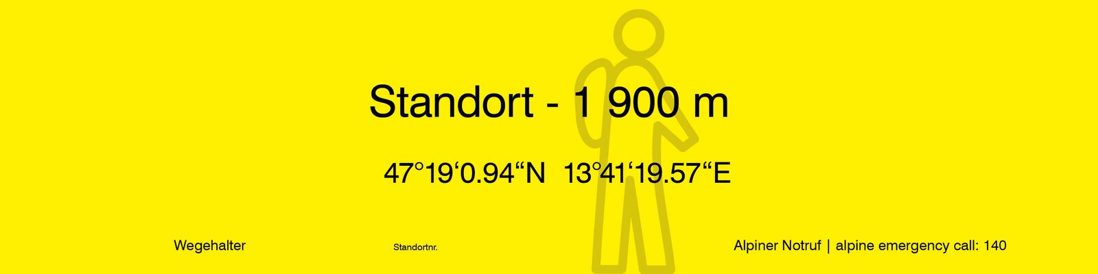
Location sign: Shows the location name, elevation, and coordinates. The footer also contains the trail marker, location number, and the alpine emergency number.
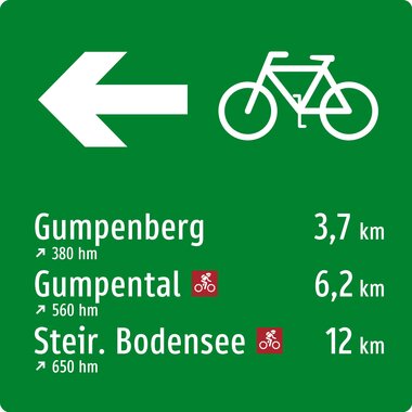
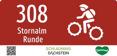
Bike signage
Bike-Beschilderung
The state of Styria created a new cycling guidance system in 2024. This will be implemented on all cycle paths, mountain bike routes, and trails in the coming years, ensuring that visitors will find a consistent approach throughout the entire state. The concept is also very similar to existing concepts in other federal states, making cross-state orientation easy.
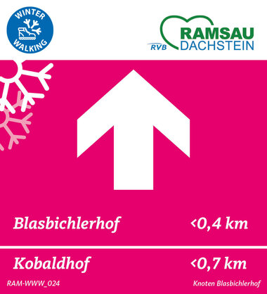
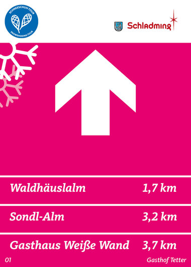
Winter hikes
without summer route
-
Winter or snowshoe hiking icon: Indicates whether the route is suitable for winter or snowshoe hiking.
-
Trail maintenance logo: Identifies the person responsible for the route and the signage.
-
Directional arrow: Indicates the direction of travel.
-
Destination information: One to several lines with destinations and optional distance information (optional for circular routes).
-
Location information: Contains the location number and location name.
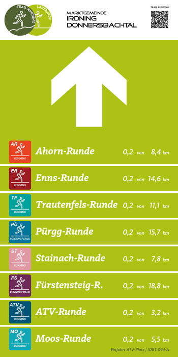
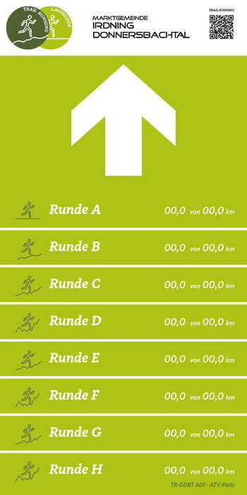
Running route signage
Laufrunden-Beschilderung
- Trail running/running icon & trail marker logo: At the top of the sign. Additionally, a QR code leading to the landing page for running routes.
- Directional arrow: Indicates the running direction.
- Running laps: One to several lines with individual icons, the lap name, and the information "x of y km."
- Location information: Contains the location and the location number.