©
(C) Herfried Marek
Strubwanderung
gemiddeld Water hikes · Naturpark Sölktäler
Tourkenmerken
Conditie
Techniek
Tourinformatie
Parcours: 2.1 km
Duur: 01:00 h
Beklimming: 200 m
Afdaling: 200 m
Beste jaargetijde
Januari
Februari
Maart
April
Mei
Juni
Juli
Augustus
September
Oktober
November
December
De tour
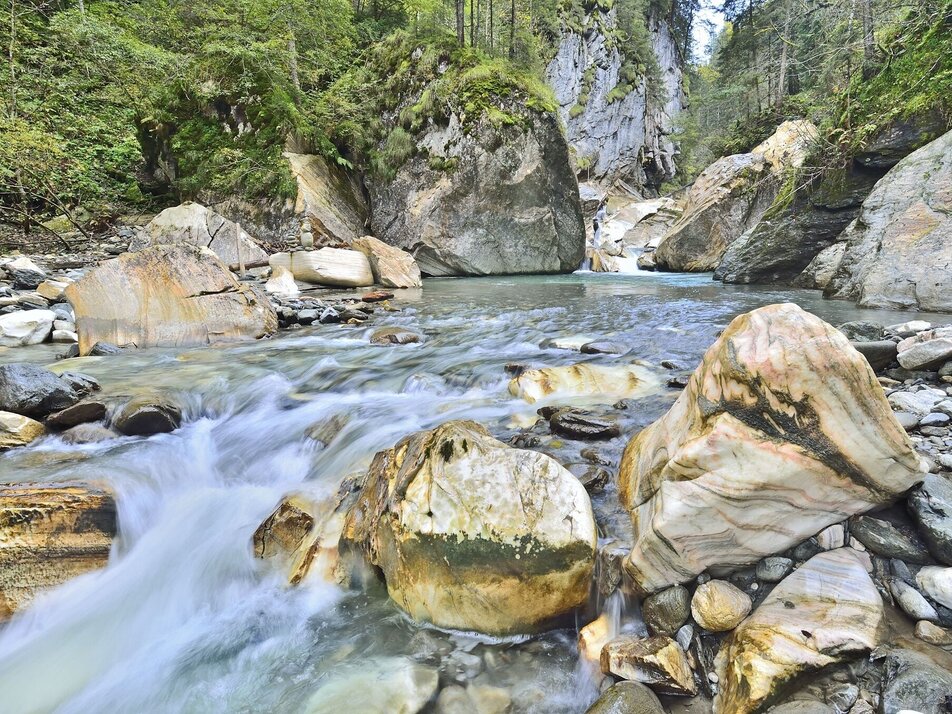
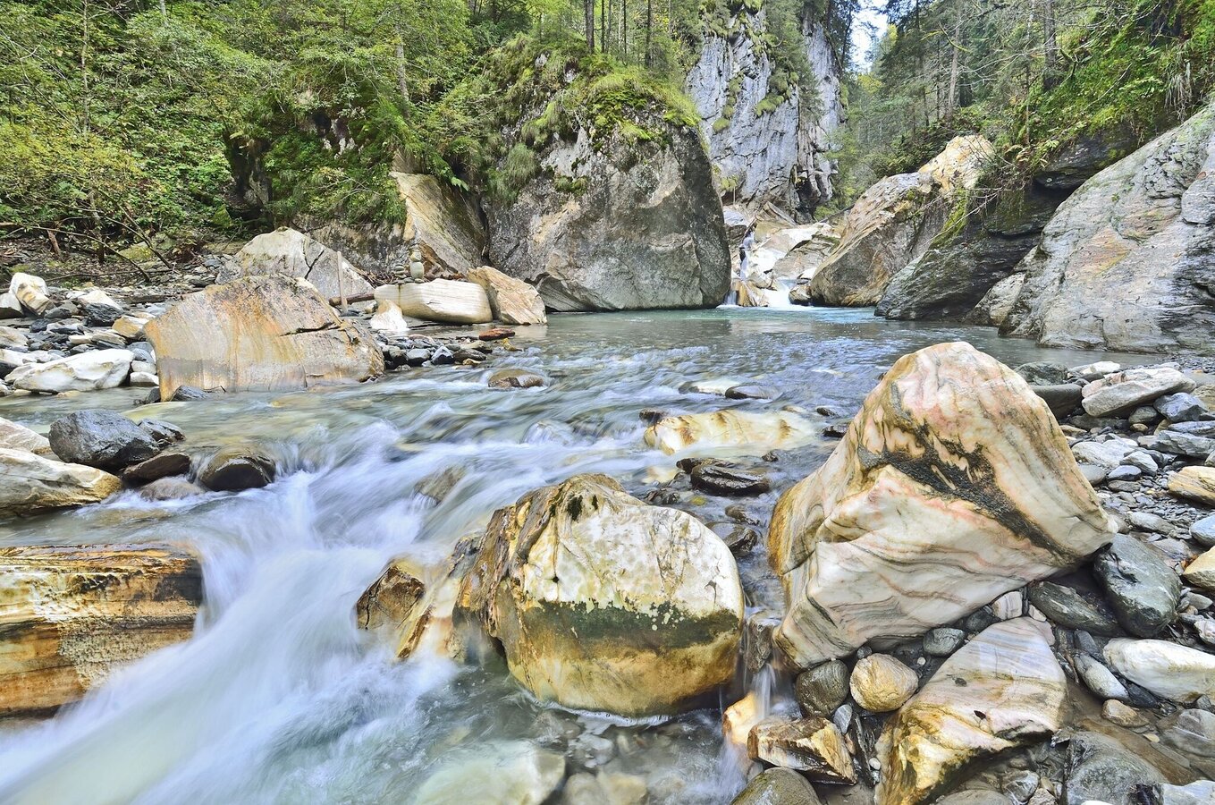
A hike through the Strubschlucht gorge near Schloss Großsölk takes you to the confluence of the Großsölk and Kleinsölk streams. There you can see how the two streams have carved their way through the marble rock. You walk for approx. 1/2 hour to the gorge, where you can cross the Kleinsölk and Großsölk streams over 2 bridges, and the calm waters and tranquillity invite you to linger on the banks. This popular hike takes approx. 1 hour and requires sturdy footwear.
The Strubschlucht can be hiked from both Sölktäler valleys:
Starting point Großsölktal: Parking lot Schloss Großsölk - here still approx. 150 m on the country road into the valley until a tractor path branches off to the right.
Starting point Kleinsölktal: Past the Sölker marble works to the next parking lot next to the country road - here via Gehöft vlg. Köck farm to the gorge.
Fotogalerij

Nadere informatie
Start
Arrival at Stein/Enns train station with ÖBB.
Cab Stefan Mayer: +43 676 54 09 858
Valley bus from July 5 to September 7, 2025 - this makes crossings in the Sölktäler Nature Park possible. You can also travel comfortably by train and the valley bus will take you to the starting point of your hike. Click here for the timetable.
Cab Stefan Mayer: +43 676 54 09 858
Valley bus from July 5 to September 7, 2025 - this makes crossings in the Sölktäler Nature Park possible. You can also travel comfortably by train and the valley bus will take you to the starting point of your hike. Click here for the timetable.
Parkeren
There is a parking lot approx. 150 m before the hike (next to the Schloss Großsölk information pavilion)
Equipment
Weather changes, rapid drop in temperature, thunderstorms, wind, fog and snow fields are objective dangers and require the right behavior on the way. Hut keepers are experienced mountain connoisseurs, they can give good tips on the weather and the course of the trail. Lack of equipment, overestimation of one's own abilities, carelessness, poor physical condition and a wrong assessment can lead to critical situations. During thunderstorms: avoid peaks, ridges and rope belays at all costs.
GPS data and orientation aids: Available GPS data - as well as hiking maps - are only an orientation aid, since they can never represent an exact image or the richness of detail of a path in reality. Especially in the case of danger spots, it must therefore always be decided in the end on the basis of the conditions on site whether and how the further course of the path looks like.
In case of emergency, please dial the following emergency numbers:
No. 140 - for alpine emergencies - Austria-wide
No. 112 - Euro emergency call GSM emergency call service
Take rainproof and warm clothes and enough water, possibly also a snack, wear shoes with non-slip profile soles. A first aid kit should also be in your backpack.
Tip van de auteur
SummitLynx- Your digital summit and hut book - available worldwide and always with you!
Overige informatie en links
Mountain guides from the region: www.schladming-dachstein.at/mountainguides
For more information, please contact the Schladming Dachstein Tourist Office - Sölktäler Nature Park Information Center:
Phone: +43 3687 23310 501
mailto:info@schladming-dachstein.at
Stein an der Enns 107
8961 Sölk
The brochure “Schladming-Dachstein Hiking” is available in all information offices in the region.
Weersvooruitzichten
Datum kiezen
Fairly sunny with scattered clouds. Showers will be possible towards evening.
Dry and fair in the early morning, then variable with frequent showers.
A chance of sunny periods in the morning, then widespread rain will build up.


