©
Roland Gutwenger
Hochmölbing Peak
moeilijk Hiking · Stainach-Pürgg
Tourkenmerken
Conditie
Techniek
Tourinformatie
Parcours: 20.83 km
Duur: 09:00 h
Beklimming: 1331 m
Afdaling: 1331 m
Beste jaargetijde
Januari
Februari
Maart
April
Mei
Juni
Juli
Augustus
September
Oktober
November
December
De tour
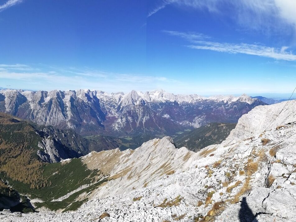
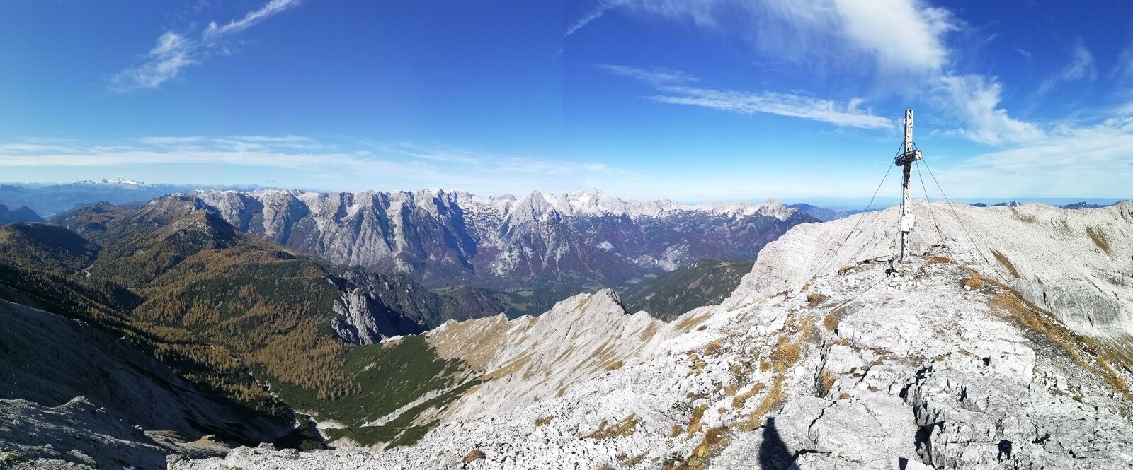
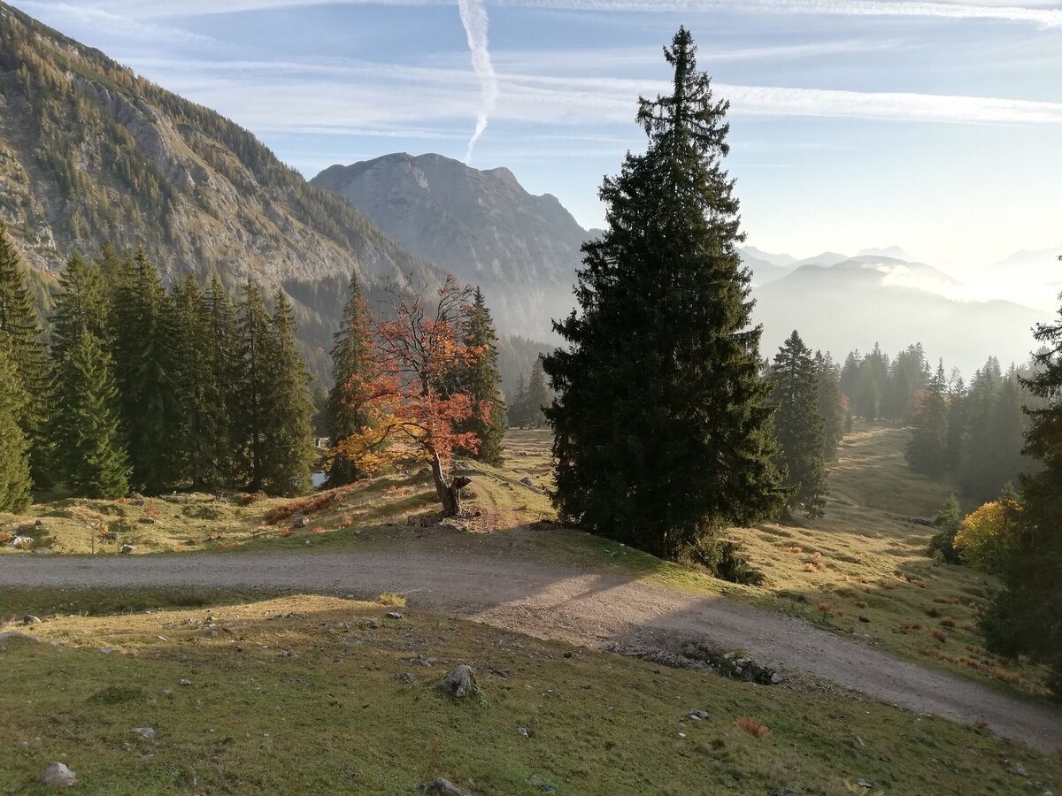
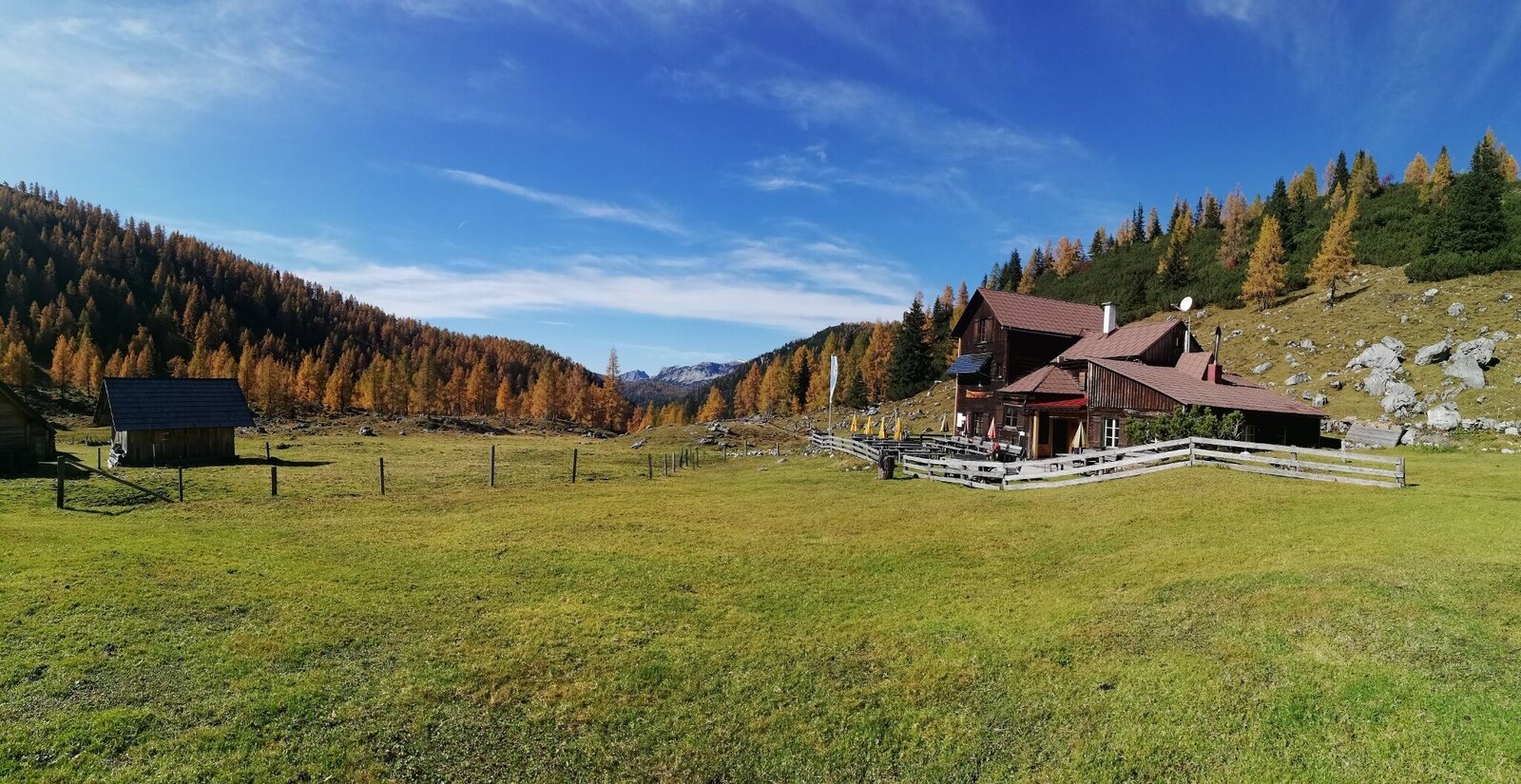
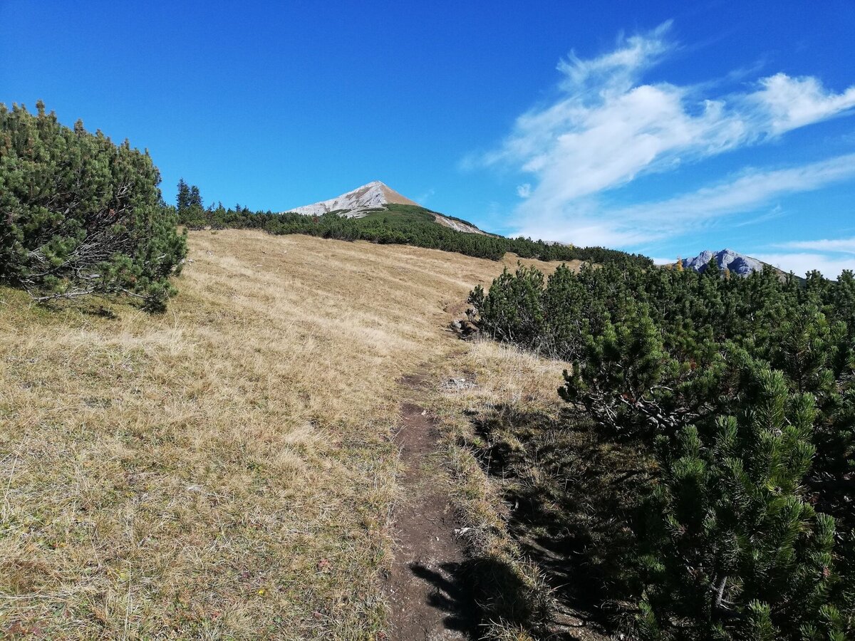
From the starting point at Schönmoos, as described before for the hike to the Hochmölbing Hütte, this is where we begin our ascent to the summit. From the hut, we follow path no. 281 (this takes us directly to the broad ridge leading to the summit), tackling the Klein- and Mittelmölbing along the way. In contrast to the Niedere Tauern, we find ourselves on the limestone of the Warscheneck Group. The imposing mountainsides of the Weissenbach in the east, and the extensive high plateau of the Totes Gebirge, with its cragged peaks, in the west, characterize the scenery here. Of course, the dark prehistoric rock of the Niedere Tauern also shows itself here, along with its deep valleys, the Dachstein Massif and its glaciers. The descent can be tackled via the original route taking us along the long ridge to the Hochmölbing Hütte, or instead from the Mittelmölbing on path no. 219 to the Speikboden and descending to the Brunnalm. There the path branches off to the Liezener Hütte, and from the hut on the south side via path No. 283 to the Hochtor and Langpolten stream, which we follow to the Langpolten Alm. We then take path No. 281 back to Schönmoos.
Duration: approximately 9h (2,5h to the Hochmölbinghütte, another 2,5h to the summit, 4h for the way back), schedule time reserves!
Fotogalerij


Nadere informatie
Routebeschrijving
The hike takes you from Schönmoos to the Hochmölbinghütte and continues on the marked trail no. 281, which leads directly to the broad ridge of the summit ascent. You reach this on an impressive ridge over the Kleinmölbing and Mittermölbing. In contrast to the Niedere Tauern, here in the Warscheneck group you are standing on limestone. The panoramic view from the summit is phenomenal. The imposing precipices of the Weissenbacher Mauern to the east and the extensive high plateaus of the Totes Gebirge with their rugged peaks to the west characterize the view here. Of course, you can also see the Niedere Tauern and the Dachstein. After an extensive rest, get ready for the descent, which either follows the ascent route via the long ridge and the Hochmölbinghütte or leads from Mittermölbing on trail no. 219 to Speikboden and the Brunnalm. There the path branches off to the Liezener Hütte. On the south side, continue on trail no. 283 to Hochtor and Langpoltenalm. Then take the ascent path back to Schönmoos.
Walking time: approx. 9 hours (2.5 hours to the hut and a further 2.5 hours to the summit, 4 hours on the way back), allow extra time!
Walking time: approx. 9 hours (2.5 hours to the hut and a further 2.5 hours to the summit, 4 hours on the way back), allow extra time!
Start
From Wörschach to Wörschachberg and further to Schönmoos
Onward journey possible by taxi.
Ennstal Taxi: +43 660 6633666
Parkeren
Schönmoos car park - On busy days the car park can be full very early. Please park in front of the Oberkogler Alm.
Start
P in Schönmoos
Bestemming
Hochmölbing
Equipment
Your weatherproof rucksack should include: Sun and rain protection, warm, windproof clothing, drinks and provisions, a small first aid kit, hiking map and a fully charged cell phone. Appropriate footwear goes without saying.
- Turn back in good time if the weather deteriorates. If you get caught in a thunderstorm, stay away from individual trees. Wait out the storm, preferably in a crouched position.
- Stay on the marked paths and remember to close pasture fences.
- Keep calm in an emergency and call the mountain rescue service on 140. If you have no reception, take out your SIM card and dial 112.
- If you come across cows: It is best to pass above the herd at a distance of at least 50 meters. Stay calm, don't make any hectic movements and don't run away. Do not imitate cow sounds and do not try to stroke the animals. A stick and loud shouts can often make the animals turn back in an emergency.
- If you are a dog owner: clarify before the hike whether you need to cross a pasture. Keep your dog on a lead and make sure it behaves calmly. In the event of a cow attack, let your dog off the lead immediately. Never pick him up to defend him.
Overige informatie en links
Tourist Info: www.schladming-dachstein.at
Schladming-Dachstein Tourist Office
Ramsauerstrasse 756
8970 Schladming
T: +43 3687 23310
info@schladming-dachstein.at
Tour at your own risk! No liability is assumed for any alpine dangers (weather, etc.). Sections of this hiking trail are part of the northern route of the long-distance hiking trail “From Glacier to Wine”.
On certain weekends, the Liezener Hütte is provided with a hut service.
Dates can be found at: https://www.alpenverein.at/liezen/huetten/liezenerhuette.php
- SCHLADMING-DACHSTEIN Hiking EAST. Available free of charge from the tourist offices and accommodation providers.
- SCHLADMING-DACHSTEIN hiking map (1:50,000)
Dit kan ook interessant zijn voor u


Weersvooruitzichten
Datum kiezen
Showers dying away in the morning. Then dry and bright with plenty of sunshine.
Fair in the early morning, later variable with frequent showers.
Starting fair, later scattered showers and finally widespread rain.


